Do you remember what you were doing on February 14, 2014?
Valentine’s Day in Looe in 2014 brought a very unwelcome present for local residents – still remembered as “the big storm”, the town saw shops, businesses and homes under more than a foot of water, the roads in and out of the village impassable and the railway line flooded.
Looe has an unwelcome history of flooding.
During the fortnightly spring tides, the sea routinely reaches the top of the quayside walls.


When a storm occurs at the same time, the water comes over the quay wall and floods the surrounding areas.
Environment Agency records show that currently the centre of the town typically floods four to eight times a year, putting more than 200 properties at risk.
Looe has been “lucky” on several occasions since 2014 where surges have not combined with high tides. In February 2020, the flooding, although significant, could have been so much worse.
On March 28 and 29 this year, roads, rail lines and car parks were closed because they were under water, leaving local people unable to access their homes and businesses.
Cornwall Fire and Rescue Service was forced to close West Looe Quay Road for several hours on March 24 as a result of the flooding, with East Looe Quay Road (from the main carpark down to Middleton’s Corner) also seeing a significant depth of water.
The Liskeard to Looe Line was closed for several hours, with a number of bus services cancelled.
The flooding also meant there was no road access to the area around the fish market for several hours on both days, affecting everyone who lives and works in this part of the town.
So what about the future?
Although the majority of storms have been less ferocious than the “big storm” of 2014, this means that many local people regularly find themselves putting out sandbags and flood barriers, and mopping up whenever the spring tides combine with strong winds.
Add in heavy rainfall combined with blocked drains or high tide levels leaving rainwater with nowhere to go leading to flash flooding.
The resilience of local residents, armed with sandbags and flood barriers, may well be enough to protect the town from all but the most severe storms today.
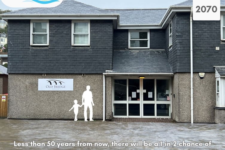
However, the impact of climate change, with sea levels expected to rise by over one metre during the next 100 years, means that in less than 50 years most of the town will flood more often and to a greater depth, meaning that sandbags and flood boards become less effective.
This will see key areas such as the health centre, the police and fire stations, the main food stores and cafes and the fish market, the main roads, the Harbour and Millpool car parks and the railway line under water on storm and high tide days. The Environment Agency estimates that the effects of climate change will mean that the centre of Looe will flood 60 times a year by 2050, with the risk of a serious flood incident, such as occurred in 2014, rising from a one in 1,000 year event to happening every year by 2080.
Today the centre of Looe floods up to eight times a year – in less than 50 years’ time it will flood 60 times a year. By 2080, the town could see a 2014 style “big storm” every single year.”
The only way to ensure the future of Looe for the children and grandchildren of the people who live here now is to adapt to rising sea levels and the increasing risk of flood, taking steps to manage the risk now to allow time for the community to adapt to the new normal.